Wednesday, May 30, 2012

The Golden Gate Bridge

As I mentioned in my last post, I was so sore when I woke up on Friday morning, I almost blew off my plans to walk the Golden Gate Bridge.  Almost. 

From the south (city side) vista point.  The bridge was started on January 5, 1933 and was completed on May 28, 1937.  I walked the bridge on May 25, 2012.  The color is called International Orange and was selected to blend in with the surrounding area.  There were more than 2000 lawsuits filed to block the building of the bridge.  Apparently, some were concerned it might hurt their property value.

Before leaving for San Francisco I found an online scavenger hunt by Mastermind Treasure Hunts.  I am determined to complete it.  However, I am due at the airport by lunch so this endeavor requires an early start.  I leave my hotel at 6:30 am.

I have been to the vista points on both sides of the bridge in the past but when I arrive at the one on the city side, I cannot park.  They are preparing for the bridge's 75th anniversary party which will happen over the weekend.

There are lots of sprucing-up efforts.  This bed was being planted while I took this picture (off to the left of the image).  The party is one day away so I guess they want it to look really fresh.  There are workers all over:  setting up a podium and seating area, cleaning, planting and more crews on the bridge doing I have no idea what.


I go across the bridge (assuring I will pay the toll to come back when I head to the airport) and park in the north parking lot, where at this time of the morning, parking is plentiful.

The distance from vista point to vista point is 1.7 miles (each way).  I didn't know until I read it later that you can't walk on the west side of the bridge.

I am not sure how you would get over there anyway.  Traffic is always flowing fast and heavy and there is no pedestrian bridge, crosswalk or anything else to get you across.

The first thing I notice as I start across is that there are a lot of signs.  Some of these will contain answers to the hunt so I photographed them to be safe.  Fortunately the hunt includes a map that gives you an idea of where to look for the various clues.

There are a few things on here that I don't understand.  Chiefly among them is why the sun is wearing sunglasses.  I can assure you that the bicyclists completely ignore the advice to "walk bikes across the bridge". 

Not only do they not walk them, if you are walking you are in danger of being run over by some of them.

Bikes have a dedicated lane.  So do men in suits wearing fedoras walking with young girls.

Since the fedora-clad men obviously hold the hands of small girls on the bridge, only the women need to be reminded not to leave children unattended. 

Injury to the bridge is a crime.  Injury to unattended children was not addressed nor was defacement of this sign.  Is it considered part of the bridge?

It is also a crime to drop a missile from the bridge.  I am woefully lacking in missiles on this trip.  I did commit a crime the last time I was in San Francisco.  More on that in my next post.

The rules for Pedestrians and Cyclists.  I suspect few people read this.  Also, it was only posted on the south side, I started on the north.

The bridge is famous as a favorite destination for suicide jumpers.  I read various stories on the Internet about the number of jumpers (this number varied greatly from 1200 to over 2000).  The first happened 10 weeks after the bridge opened.  In 2011, there were 37 jumpers.  Some of the bodies are never found.  Those who survive the jump (it happens) usually drown or die of hypothermia. 


This chain-link fence with barb-wire top doesn't go very far.  The rail isn't very high, about hip high in most places.  It would not be difficult to climb.

There are several call boxes and alarms along the bridge. 

Because the consequences of jumping are (almost always) fatal but more important...are tragic.

The drop to the water is between 220 and 245 feet (depending on the source).  There is only this small area sticking out on the other side of the rail.  Not much to clear with your jump.  It takes about 4 seconds after jumping to hit the very cold water below.

I read a story in Time about a man who jumped and survived.  He answered one of my questions:  What does a person think right after jumping?  He said he immediately thought, "I don't want to die". Four seconds is not a long time but it is probably an eternity to the jumper.  Definitely time to have second thoughts.  One article said that of the hundreds that have jumped only about two dozen have survived (the jump, drowning, freezing, broken neck/back, massive internal damage). 

The push to have a suicide barrier comes up over time.  One idea is to have a net but some opponents wonder what would stop the person from climbing out of the net.  They also don't want to spoil the view and you never know, it could hurt property values.  The view really is spectacular.


The people who created the hunt mentioned on their website that it might be best to do the hunt after the anniversary party due to some areas being closed.  I did have some problems finding some of the answers.

I didn't find any of the items in the flag area.  I also know that one of my answers is wrong because you are supposed to take the letters in the numbered slots and put them on the second page to reveal 3 facts about the bridge.  I had a J in several places where it made no sense.

I was able to use all I ever learned from Wheel of Fortune to figure out the missing letters.  The facts are: 1)  When it was built the Golden Gate Bridge was the longest suspension bridge in the world; 2) There are five foghorns on the bridge; 3) The US Navy wanted the bridge to be painted with black and yellow stripes for visibility.

Maybe that is why the statue at the Lone Sailor Memorial isn't looking at the bridge.  He didn't see it because it blended too well with the landscape instead of looking like a huge bumblebee.

When I completed the 1.7 mile walk from the north vista point to the south, I met with Joseph B Strauss, the chief engineer of the bridge.

I think he should have been looking out at what I can only assume was his greatest achievement.

When I looked over his head to the bridge, I had a thought about my achievement of walking the whole distance across.  It was, crap, now I have to walk all the way back.


Monday, May 28, 2012

Walking Tour of San Francisco

One of my favorite things about San Francisco is that you don't need a car to get around.  In fact, in the near dozen times I have been there, I have only had a car twice, and this was one of them.

There are three reasons I don't like to have a car here:
  1. Traffic and not just the car type.  I am not from a pedestrian-centric area and they are everywhere here.  They assume you are going to stop and when the walk sign comes up, they walk.  When I first came here this stressed me out because you would NEVER do that in the Dallas area unless you want to get hit by a car.
  2. Parking is expensive and not always convenient.  On this trip the parking garage to my hotel is a block away.  Me and my suitcase don't always get along - I want it to roll normally and it has other ideas.  Lugging your stuff a block and crossing two streets is not easy and in some areas, might be less than safe.
  3. You don't need one.  You can walk or get transit to go anywhere in the city.
When I get ready to walk to my customer's office on the first day, I have been there before and don't really need a map but I ask the hotel for one anyway.  I am starting to feel confident without a map in my usual neighborhoods - Union Square and the Financial District.  Here is the map the hotel gave me:

The black X represents the hotel so I am near the middle.  The area to the north includes Nob Hill, Chinatown, North Beach, Russian Hill and Fisherman's Wharf.  The area to the east includes Financial District.  My hotel is in Union Square.  The area immediately to the west is the Tenderloin.  I once wandered into this area and realized pretty quickly that I needed to wander back out.

There are a number of other neighborhoods I haven't been to and even after this trip, still haven't.  When I return with David in June, we plan to try and see some of these, in particular Haight-Ashbury, Castro, Mission and the area around Alamo Square which has the houses you know from the TV show Full House

The amazing thing is that the city is only about 7 miles across by 7 miles wide.  You would think it would be easy to see it all.  It isn't.  There is so much...so much to see, so much to do.  I walked more in 4 days in the city than I would walk in a month at home.  Here is a walking tour of some sights from this trip:


Teuscher Chocolates of Switzerland near Union Square.  If you buy one of the little figures, they put a truffle of your choice inside.  Sorry Felicia, I ate your truffle.

The Transamerica Building, near/in the Financial District.  Also known to David as "The Big Tall Pointy Building."  It is no longer home to Transamerica.  It is the tallest building in San Francisco and according to Wikipedia was once in the top 5 in the world.  The public is not allowed access so no views from in here.  This is one of my landmarks.  If I get turned around, I look for this building and a couple of others to help me get my bearings. 

Hanging out the laundry in Chinatown.  This view isn't special to Chinatown, you can see laundry hanging outside in several neighborhoods.

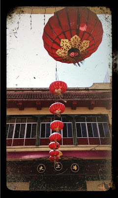
Lanterns in Chinatown.  There are several rows of these running across Grant Street in the heart of the Chinatown shopping district.  I was surprised the first time I went to Chinatown.  I expected more unique and interesting shops but most are the same and they mainly sell cheap souvenirs. 

Union Square Park.  This area is surrounded by shopping, Macy's, Nordstrom's and many, many, many, many others.  My hotel is about two blocks from here and I walk past this probably 30 times during my 4 days in the city.  Sometimes there are concerts and other events here and on weekends there are artists set up to sell their work. 

Fire Escape.  This is an alley near my hotel.  Most alleys are pretty clean, but not always.  The buildings are close together, if not touching and most are multi-story making fire escapes a common sight.

It is amazing how you will walk through a really rundown area to turn the corner to find a really nice area just one street over.  Some areas have little to no landscaping while others do a nice job trying to add some greenery.

The Abraham Lincoln Brigade Monument near the Ferry Building and Embarcadero Center. You can walk on stones or steps to get inside - if you don't mind getting a little wet from the spray.

You are never alone in this city.  There is always someone on the street, in the stores, in the restaurants, in the parks and watching from their windows.

And there are little unexpected surprises if you pay attention.  I found this in a window box on Hyde Street in/near the Russian Hill neighborhood.

This building at the corner of California & Kearney has 12 statues, 3 on each side of the 23rd floor looking out over the Financial District and the city.  I think they look like wraiths (or grim reapers) but  these figures by Muriel Castanis are usually referred to as Goddesses or Corporate Goddesses.  This is another one of my landmarks because the first several times I came here I stayed in a hotel that required me to walk past these multiple times every day.

There are some spectacular views in this city.  This is the view looking East from Hyde & Lombard Streets (Lombard is the really crooked street you always hear about or see in pictures) in Russian Hill.  The tall building on the left is Coit Tower.  You can walk up there and go in the Tower and get a 360 degree view (it is a steep walk no matter how you get there - street or stairs).  Another one of my landmarks, David calls this the "Big Ass Flashlight" or BAF for short.  The bridge in the distance is the Bay Bridge which takes you to Oakland.

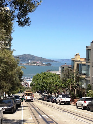
A streetcar approaches.  I never use the public transit here, mainly because I am too nervous.  I don't know how much it costs, whether I need exact change, where to get on, where it will take me.  So I walk.  That is Alcatraz in the distance.  I have done this tour twice (highly recommend, very interesting self-guided tour) and will be doing it again on our upcoming trip.  This time we are going at night.

Breadmaker at Boudin's in Fisherman's Wharf.  The high availability of sourdough bread in this city negates any health benefit I get from all of this walking.

And I thought I did a LOT of walking.  I took the map the hotel gave me and marked off all of the streets I walked each day.  At the end of the week, it looked like this:

So much less than I expected.  I felt like I walked the entire city. 

In my defense, this map doesn't show how many times I walked up and down a particular street and, in many cases, it was several times.  My longest walk was on the last day when I tried to find the Cable Car Museum but when I got to where it showed on the map, I couldn't find it.  I walked several blocks zig-zagging around trying to find it but never did.  The walk from the hotel to here is pretty steep in places.  And if you think going down the hills here is easier than going up...you would be mistaken.

So, I decided to keep going and walk down Lombard and on to the water.  Then back to my hotel down The Embarcadero through Fisherman's Wharf, past Pier 39 and all the way to the Ferry Building.  Not a short trip or an easy one fighting all of the tourist foot traffic (this is the arched line at the top right of the map).  When I got to the Ferry Building, I sat down at the park across the street and immediately realized that was a huge mistake. 

The Ferry Building at The Embarcadero & Market Street.  There was a farmer's market going on outside and some art vendors across the street.  Inside, there are a variety of restaurants and food-oriented stores.

When you aren't used to walking that much it is best to keep going.  The next morning when the alarm went off at 5 am, I almost decided to stay in bed my body was so sore.  But I didn't, I got up because before I go to the airport...


...I am going to walk the Golden Gate Bridge.

Thursday, May 24, 2012

Santa Rosa & Sonoma County California

I am expected in Santa Rosa at 9 am.  The mapping site says it will take me approximately 1.5 hours to arrive.  Being a cautious person, that means I will leave at 6 am.


To drive from San Francisco to Santa Rosa I will cross the Golden Gate Bridge.  It is free to leave the city, I will have to pay to return.


There are also parking areas on both sides of the bridge for photo opportunities and to walk on the bridge, which I will do before returning home.  This is the view looking towards the Bay Bridge, which takes you to Oakland, around 6:30 am.


Because I leave so early, I run into no traffic problems and arrive in Santa Rosa around 7:30.  I take a detour to downtown and through town back toward my customer's location.  It isn't what I expected.  This is wine country, I expected it to be beautiful and lush.  It looks like any other city.


After a full day at the office, my customer needs me to go kill some time while she checks email and wraps up a few things.  She has offered to drive me to the coast which apparently isn't too far away.  After a short consultation with some other people, they send me to an outdoor shopping area in a nearby town.


For a health-conscious state, I have seen a surprising number of candy and chocolate shops.  This little shopping district has one, several restaurants and a yogurt shop.  I wanted yogurt the night before but couldn't find a place close to my hotel.  I decide to have some and not disclose to my customer I ate, so she won't decide to ditch me and go home.

There is a green space here so I eat my yogurt and watch a mother and child fly a kite.  There are a lot of teenagers hanging around and I notice that, for a  shopping area, there aren't many adults around.  Going back to my car, I see Snoopy.

Amarillo had horses, San Francisco has hearts, this area has Peanuts.  When I saw this I remembered that over lunch someone mentioned that there is a museum for Charles M. Schultz here.

I locate the museum on the GPS and head that way.  Business travel is frequently unfriendly to sight-seeing.  The museum is closed and I wouldn't have made it had I come straight here.  I am able to check out several statues outside.


The official name is:  The Charles M. Schultz Museum & Research Center


The placard on the corner says, "This is a piece of art.  Please stay off the statue."

I really wanted to take a photo of Snoopy handing me one of these cookies but this is also a problem with business travel.  I am alone and...

...my arms aren't long enough which is why you can't easily tell this is me with Joe Cool.

I was able to see in the front windows and it looks like it would have been interesting.  If I am ever in the area in the future, I will definitely try to come back.

There is also an ice-skating rink, cafe and gift shop across the street.  The gift shop was open.  I had to make a quick lap as my customer called and said she was ready to play.

I return to meet her and thankfully she drives leaving me free to look.  About 10 minutes into the drive, it finally looks like I expected.  I didn't get to take any photos as it is a two lane, no shoulder road with people whipping along but it was beautiful.  Large vineyards, cute towns.  We are following the Russian River towards the Pacific Ocean.

Some of the towns were fishing oriented and many of them had little cafes or restaurants specializing in seafood, which is my favorite kind of food.  As of this writing, I have eaten salmon every day and sometimes twice a day.

When we reach the ocean it is rocky and beautiful.  I like this landscape over a sandy beach.  There is however, one major problem.

We are dealing with gale-force winds.   When I opened the door the wind yanked it so hard I thought my arm would pop out of the socket.  My hair was constantly in my face and taking pictures was very difficult for two reasons aside from fighting my hair:

1) It is hard to hold the camera still.  (This is Goat Rock.)

2)  The wind is quite literally trying to rip the clothes right off my body.  (This is Arch Rock.)

I am dressed for work, not for traipsing around on windy cliffs.  While taking this picture I realize my shirt has shifted so far that I am perilously close to completely exposing one breast. (Don't get too excited, I have the proper undergarments in place, unmolested by the wind.)  However, trying to hold a camera still while holding your shirt together so you don't continue to flash the people sitting in their car watching you makes picture taking something like an Olympic sport.

Getting wet from the spray while continuing to clutch my shirt at the base of Goat Rock.
The yogurt has worn off and I am sufficiently wind blown for one day so we head to the restaurant, where I have - what else - salmon.  

On the drive back to my car we go through Bodega, California where some of the Alfred Hitchcock movie The Birds was filmed.  We can see the outline of the church which is still there but unfortunately it isn't lit up.  According to IMDB.com, the schoolhouse here is supposedly haunted, so maybe I can talk David into a return trip someday.

By the time I get back to my car it is 9:30 pm and I have the drive back to San Francisco ahead of me.  Luckily, I find The Wolfman Jack program on the radio so I crank it up and sing at the top of my lungs all the way back to the city.  Sometimes traveling alone is a good thing.

Sunset on the Pacific Ocean